You’ve probably seen the little mountain icon labeled "Mount Sinai" on most Bible maps or Google Maps, tucked right into the southern tip of the Sinai Peninsula. It looks definitive. It looks like a settled fact. But honestly, if you start digging into the archaeology and the actual text of the Exodus, that little pin on the map starts to feel a bit... shaky.
Locating mt sinai on a map isn't just about finding a pile of granite in the desert; it’s a massive geographical detective story that has been running for about two thousand years. Most people just assume the traditional spot—Jabal Musa—is the place because it has a gorgeous 6th-century monastery at its base. But did you know there are at least a dozen other candidates? Some scholars think we should be looking hundreds of miles to the east, in the volcanic fields of Saudi Arabia.
Where Exactly Is Mt Sinai on a Map?
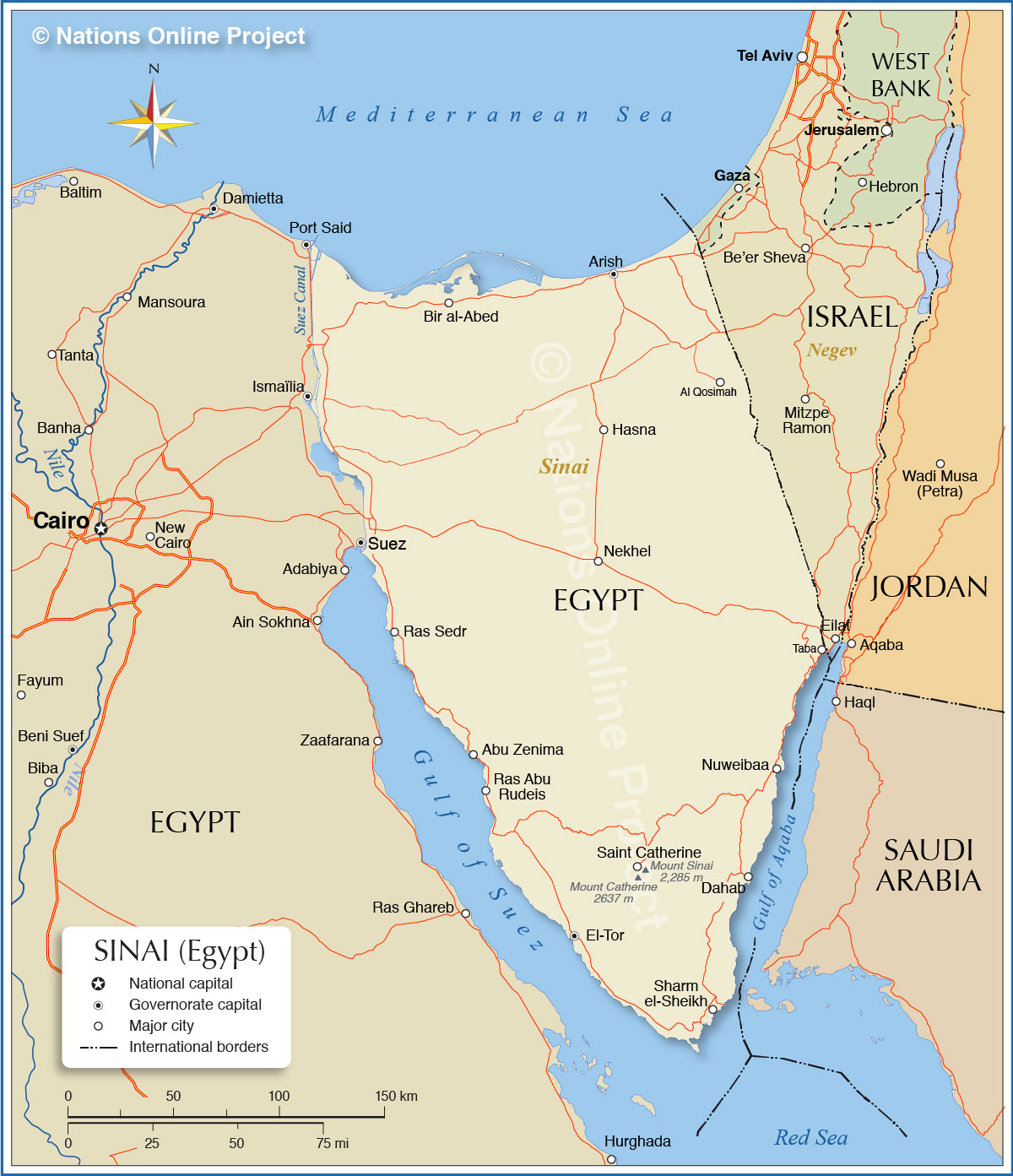
If you open up a standard GPS today and type in the coordinates, you’ll likely be directed to 28.539° N, 33.975° E. This is Jabal Musa (the Mountain of Moses), a 7,497-foot peak in Egypt.
It’s a rugged, stunning place. You can actually hike the "Steps of Penitence"—3,750 stone stairs carved by monks—to reach the summit. At the bottom sits St. Catherine’s Monastery, which is basically a time capsule. It’s the oldest continuously inhabited Christian monastery in the world. It’s got a "Burning Bush" that is still green and a library that rivals the Vatican’s.
The Geographic Conflict
But here’s the thing: the Bible says Moses was pasturing sheep for his father-in-law, Jethro, who was a priest of Midian. On a modern map, Midian is almost certainly in northwest Saudi Arabia, across the Gulf of Aqaba.
Would Moses really have driven a flock of sheep hundreds of miles across the blistering Sinai desert just to find some grass at the base of Jabal Musa? Probably not. This one detail is why a growing number of researchers are shifting their eyes across the water.
The Saudi Arabia Theory: Jabal al-Lawz
In recent years, the "Saudi Sinai" theory has exploded in popularity, thanks in part to explorers like Bob Cornuke and the late Ron Wyatt. They point toward a mountain called Jabal al-Lawz (or the nearby Jabal Maqla).
If you look at this version of mt sinai on a map, everything changes. The crossing of the Red Sea wouldn't have happened at a shallow marsh or the Gulf of Suez; it would have happened at the Gulf of Aqaba, perhaps at Nuweiba Beach where there's a massive underwater "land bridge."
- The Blackened Peak: One of the weirdest things about Jabal Maqla is that its summit is jet black, while the rest of the mountain is a light tan. It looks scorched.
- The Altar: Proponents claim there are massive stone structures at the base that look like Egyptian-style calf altars.
- The Split Rock: There’s a giant, six-story tall boulder in the area that is split right down the middle, with signs of massive water erosion at its base—sort of like the Rock of Horeb described in Exodus.
Mainstream archaeologists generally roll their eyes at this. They’ll tell you the "scorched" rock is actually just dark metamorphic basalt and that the "altars" are just old Neolithic structures. It's a heated debate, and frankly, Saudi Arabia hasn't always been the easiest place for western researchers to go poke around with shovels.
Other Contenders: The Negev and the North
We can't just talk about Egypt and Saudi Arabia. There’s a third camp that thinks the mountain is in the Negev desert in Israel.
Archaeologist Emmanuel Anati spent decades arguing for Har Karkom. It’s a mountain covered in thousands of pieces of rock art, including drawings that look suspiciously like the Ten Commandments or a Menorah. The catch? The archaeology there dates back to about 2000 BCE, which is way earlier than most people date the Exodus.
Then you’ve got the "Northern Route" fans. They think the Israelites took the "Way of the Philistines" along the Mediterranean coast. If that’s true, mt sinai on a map would be a much lower hill in the northern Sinai plateau, like Gebel Sin Bisher.
Why the Map Matters for Travel Today
If you’re actually planning to go there, you're almost certainly going to the Egyptian site. It’s the only one set up for tourism.
Kinda weirdly, the "real" location might not even matter to the thousands of pilgrims who climb Jabal Musa every year. They arrive at 2:00 AM, hike in the freezing dark, and wait for a sunrise that turns the entire granite range into a glowing orange sea. It's a spiritual experience regardless of the GPS coordinates.
Actionable Steps for Your Own "Map Search"
If you're trying to visualize or visit the site, here's the best way to handle it:
- Check the Sinai Peninsula: Look for St. Catherine, Egypt. This is the "Traditional Mount Sinai." It's accessible via a 3-hour drive from Sharm el-Sheikh. You need a local Bedouin guide to hike it at night.
- Toggle to Satellite View: Search for Jabal al-Lawz in Saudi Arabia. Look at the terrain. You'll see how much more "volcanic" and rugged it looks compared to the Egyptian site.
- Cross-Reference the Bible: Read Exodus 3 and Galatians 4:25. Paul specifically mentions "Mount Sinai in Arabia." In the Roman era, "Arabia" covered a lot of ground, including the Sinai Peninsula, but for many, it's the smoking gun for a Saudi location.
- Download Offline Maps: If you actually go to the Sinai Peninsula, cell service is spotty once you hit the wadis. Download the "South Sinai" region on Google Maps before you leave your hotel.
The truth is, we might never have a 100% confirmed location. Over 3,000 years of wind, sand, and shifting borders have a way of blurring the lines. But looking for mt sinai on a map forces you to engage with the geography of the Middle East in a way that makes the history feel a lot more real. Whether it's a granite peak in Egypt or a blackened summit in Saudi Arabia, the search itself is half the point.